Nova Scotia Lobster Fishing Areas (LFAs) Explained
Lobster fishing areas in Nova Scotia explained: where each LFA runs, which DFO office manages it, licences, trap limits, sizes, seasons and how to read the map.
By NovaShell Editorial Team · · 11 min read
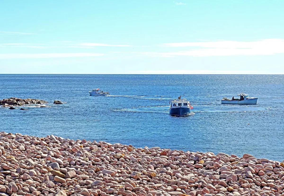
Nova Scotia’s lobster waters are divided into numbered Lobster Fishing Areas (LFAs), and every trap in the province sits in one of them. Twelve inshore LFAs touch the Nova Scotia coast: 25, 26A and 26B along the Northumberland Strait and western Cape Breton, and 27 to 35 from northern Cape Breton around the Atlantic coast and into the Bay of Fundy. Beyond 50 nautical miles lies the offshore LFA 41, and LFA 40 on Browns Bank is closed to lobster fishing. Each LFA has its own season, trap limit and size rules, and a commercial licence gives access to one specific area.
This pillar guide covers the lobster fishing areas of Nova Scotia one by one: where each runs in plain language, which Fisheries and Oceans Canada (DFO) office manages it, how many licences fish it, and its key rules. For the dates, read our Nova Scotia lobster season guide, and for the bigger picture see the complete guide to Nova Scotia lobster.
What is a lobster fishing area?
A lobster fishing area is a block of sea, defined in law, inside which one set of lobster rules applies. The boundaries are set out as maps and latitude and longitude points in Schedule XIII of the federal Atlantic Fishery Regulations, 1985. Schedule XIV of the same regulations sets each LFA’s close time and minimum legal size. Licence conditions and DFO notices then add trap limits, female size windows and the actual season dates for each year.
The LFAs that touch Nova Scotia are split between two DFO regions:
- DFO Maritimes Region manages the inshore LFAs 27 to 38 and the offshore LFA 41. Its territory is the whole Bay of Fundy and all Nova Scotian waters along the Atlantic coast to the tip of Cape Breton.
- DFO Gulf Region manages LFAs 23, 24, 25, 26A and 26B in the southern Gulf of St. Lawrence. Of these, 25, 26A and 26B touch Nova Scotia.
Inside Maritimes Region, DFO’s inshore lobster management plan gives operational lead to three area offices and the regional headquarters:
| LFAs | DFO office with the lead |
|---|---|
| 27–32 | Eastern Nova Scotia Area Office, Sydney |
| 33–34 | Southwest Nova Scotia Area Office, Yarmouth |
| 35 | Regional Headquarters, Dartmouth |
| 36–38 | Southwest New Brunswick Area Office, St. George |
Lobster fishing areas in Nova Scotia at a glance
Licence counts are DFO’s figures as of December 31, 2021. Trap limits are for a full-time (Category A) licence. The Gulf figures are from DFO Gulf’s 2025 and 2026 plans and apply to Gulf Nova Scotia harvesters where DFO lists them separately.
| LFA | Plain-language area | Licences (2021) | Trap limit | Minimum size |
|---|---|---|---|---|
| 25 | Western Northumberland Strait | Not published by area | 225 (Gulf Nova Scotia) | 79 mm |
| 26A | Southeastern Northumberland Strait, Nova Scotia–PEI | Not published by area | 280 in 26A-1 (Gulf NS); 255–275 in 26A-2; 250 in 26A-3 | 76–81 mm by sub-area |
| 26B | Western Cape Breton, including Chéticamp | Not published by area | 250 | 82.5 mm (South), 84 mm (North) |
| 27 | Northern and eastern Cape Breton, Cabot Strait | 514 | 275 | 82.5 mm |
| 28 | Bras d’Or Lake | 14 | 250 | 84 mm |
| 29 | Southern Cape Breton to the Strait of Canso (roughly) | 62 | 250 | 84 mm |
| 30 | Southeastern Cape Breton (roughly) | 20 | 250 | 82.5 mm |
| 31A | Guysborough County (roughly) | 71 | 250 | 82.5 mm |
| 31B | Eastern Shore (roughly) | 70 | 250 | 82.5 mm |
| 32 | Eastern Shore to the Halifax area (roughly) | 156 | 250 | 82.5 mm |
| 33 | Halifax area to Shelburne County (South Shore) | 680 | 250 | 82.5 mm |
| 34 | Southwest Nova Scotia | 979 | 375, rising to 400 from April 1 | 82.5 mm |
| 35 | Upper Bay of Fundy | 94 | 300 | 82.5 mm |
| 41 | Offshore banks, beyond 50 nautical miles | Separate offshore plan | No inshore trap limit | Separate offshore plan |
“Roughly” marks areas where DFO publishes boundary coordinates but no plain-language description, so our place names are a reading of the coordinates. Use DFO’s maps for anything that matters.
How to read the DFO LFA map
There’s no single interactive map of every Nova Scotia LFA, but three official sources between them cover everything:
- The Maritimes map. DFO’s inshore management plan for LFAs 27–38 includes a map of all the Maritimes Region LFAs (Figure 2), with the 50-nautical-mile line and the LFA 40 box on Browns Bank.
- The Gulf maps. DFO Gulf Region’s lobster fishing areas page has an overview map and a separate map and coordinate table for each Gulf LFA, plus LFA 27. DFO notes that these maps are for visual reference only, have no official sanction, and use the NAD27 datum.
- The legal boundaries. Schedule XIII of the Atlantic Fishery Regulations contains the official maps and boundary points.
When you read any of these maps, keep four things in mind:
- Boundaries are straight lines. Each LFA boundary runs out to sea from a fixed point on the shore. Where that point is a headland or harbour, the line may cut across a bay, so neighbouring wharves can sit in different LFAs.
- Inshore areas reach out 50 nautical miles. That’s about 90 km, and the 50-nautical-mile line divides the inshore fishery (LFAs 27–38) from the offshore fishery (LFA 41). In practice, eastern Nova Scotia’s fishing happens mostly within 15 km of shore.
- Some LFAs have sub-areas. DFO Gulf splits 26A into 26A-1, 26A-2 and 26A-3, and 26B into North and South, each with different dates and sizes. In the Bay of Fundy, Area 38B is a summer-fished part of LFA 38.
- Maps don’t show the rules. The trap limits, sizes and seasons come from the year’s DFO notice, not the map.
Gulf Region LFAs: the Northumberland Strait and western Cape Breton
LFA 25
DFO Gulf describes LFA 25 as “the northwestern part of Northumberland Strait between New Brunswick and Prince Edward Island.” Most of it is off New Brunswick and PEI, but DFO’s LFA 25 plan sets separate rules for Gulf Nova Scotia harvesters, so a share of the fleet fishes from the Nova Scotia shore. It is the only late-summer inshore fishery touching Nova Scotia. Under DFO’s five-year schedule, it opened on Monday, August 10, 2026, and is due to open on Monday, August 9, 2027. The 2025 rules set a 79 mm minimum size, a 115 mm maximum size for females, a 152 mm maximum trap entrance hoop and 225 traps for Gulf Nova Scotia licences, compared with 250 in PEI and New Brunswick.
LFA 26A
LFA 26A covers “the southeastern part of Northumberland Strait between Nova Scotia and Prince Edward Island” and the western half of the waters between PEI and Cape Breton. On the Nova Scotia side, that’s the north shore of mainland Nova Scotia facing PEI. DFO’s 2026 Gulf plan divides it into three sub-areas but doesn’t describe their geography:
- 26A-1 has separate rules for PEI and Gulf Nova Scotia harvesters. Gulf Nova Scotia licences may fish 280 traps with a 76 mm minimum.
- 26A-2 has a 78 mm minimum, with 255 traps (or 275 for some communal licences).
- 26A-3 has an 81 mm minimum and 250 traps.
All of 26A releases females from 115 to 129 mm, and it fishes in spring. In 2026, 26A-1 and 26A-2 ran April 27 to June 27, and 26A-3 ran April 20 to June 20.
LFA 26B
LFA 26B is “the eastern half of Northumberland Strait between Prince Edward Island and Cape Breton” and “the entire western coast of Cape Breton.” DFO splits it into 26B South (82.5 mm minimum) and 26B North (84 mm minimum, 152 mm maximum trap entrance hoop). Chéticamp is in 26B North, where the 2026 plan closes fishing inside Chéticamp Harbour. Both have a 250-trap limit and fish in spring. Like the rest of the Gulf LFAs 23 to 26, 26B now requires electronic logbooks.
Eastern Nova Scotia: LFAs 27 to 32
These six areas, from northern Cape Breton to the Halifax area, are run from DFO’s Sydney office. All fish in spring, and in 2026 they started a five-year pilot that shifts their season dates without changing season length. LFA 28 is not part of the pilot. Details are in DFO’s 2026 notice for LFAs 27–32.
LFA 27: northern and eastern Cape Breton
DFO describes LFA 27 as “rectangular in shape.” It covers the northeastern coast of Cape Breton and about three-quarters of Cabot Strait, plus part of the Atlantic southeast of Cape Breton. With 514 licences in 2021, it is by far the biggest of the eastern areas, and 33 of those licences were based in DFO’s Gulf Region. It has the highest trap limit in the east, 275, and an 82.5 mm minimum. The 2026 season ran May 8 to July 8.
LFA 28: Bras d’Or Lake
LFA 28 is the inland sea at the heart of Cape Breton, labelled “Bras d’Or Lake” on the regulation map. It’s the smallest fleet in the province, with 14 licences in 2021, half of them communal commercial licences. The minimum size is 84 mm and the maximum trap entrance hoop is 153 mm.
LFA 29: southern Cape Breton
From the coordinates in Schedule XIII, LFA 29 runs roughly from the St. Peter’s area west to the Strait of Canso, taking in Isle Madame in Richmond County. It had 62 licences in 2021, an 84 mm minimum and a 153 mm maximum hoop.
LFA 30: southeastern Cape Breton
LFA 30 is a short stretch of the southeastern Cape Breton coast with only 20 licences. Its signature rule is a maximum size of 135 mm for females, which protects the largest, most productive breeders.
LFAs 31A, 31B and 32: Guysborough County and the Eastern Shore
These three areas run roughly from Guysborough County along the Eastern Shore to the Cole Harbour area east of Halifax.
- LFA 31A (71 licences) releases females between 114 and 124 mm, a “closed window”.
- LFA 31B (70 licences) and LFA 32 (156 licences) have mandatory v-notching of female lobsters. They were also the first eastern areas to open in 2026, on April 9.
The South Shore and southwest: LFAs 33 and 34
These two areas, run from DFO’s Yarmouth office, are the heart of the Nova Scotia lobster fishery. They share a season, from the last Monday in November to May 31, and the opening is known as Dumping Day. Both have a maximum vessel length of 15.24 m (50 ft), while other Maritimes LFAs allow vessels up to 19.8 m (65 ft).
LFA 33: Halifax to Shelburne County
DFO’s residency rule for new LFA 33 licences describes the area well. Applicants must live in Lunenburg or Queens counties, in Shelburne County east of the Barrington River, or in Halifax County west of the western edge of Cole Harbour. QCCR reported in 2025 that the area runs from Cow Bay to Shelburne and has 678 licence holders, each limited to 250 traps. In the 2024-25 season, LFA 33 landed over 7,100 tonnes worth more than $180 million, according to preliminary DFO figures cited by QCCR.
LFA 34: southwest Nova Scotia
LFA 34 covers the waters off Yarmouth and Digby counties and the western end of Shelburne County, beyond LFA 33’s boundary at the Barrington River. It has the most inshore lobster licences of any LFA, 979 in 2021. The trap limit is 375 until March 31, then 400 from April 1 to May 31. In 2024-25, preliminary DFO figures put its landings at over 14,400 tonnes worth about $360 million. About 57% of the LFA 40 closed area on Browns Bank lies inside LFA 34’s outer waters.
The Bay of Fundy: LFA 35 and its neighbours
LFA 35: the upper Bay of Fundy
LFA 35 takes in the upper Bay of Fundy and is fished from both the Nova Scotia and New Brunswick shores. It’s the only Maritimes LFA managed directly from DFO’s regional headquarters in Dartmouth. Its 94 licences (2021) may fish 300 traps each, and the minimum size is 82.5 mm. LFA 35 has a split season: October 14 to December 31, then the last day of February to July 31.
LFAs 36, 37 and 38
LFAs 36, 37 and 38 lie in the Bay of Fundy off New Brunswick and are managed from DFO’s St. George, New Brunswick office, so we treat them as neighbours rather than Nova Scotia areas. LFA 37 is a small area shared by LFA 36 and LFA 38 licence holders, who fish it under their own area’s conditions. Area 38B, the “Disputed Zone” around Machias Seal Island, is claimed by both Canada and the United States. It is fished in summer by LFA 38 licence holders who apply each year.
Offshore: LFA 41 and the LFA 40 closure
LFA 41 is the offshore fishery beyond the 50-nautical-mile line in DFO Maritimes Region. It’s managed under a separate offshore lobster and Jonah crab plan, and the Atlantic Fishery Regulations leave it open all year except January 1 and 2. It is also the one LFA exempt from the regulation limits on trap dimensions (125 cm long, 90 cm wide and 50 cm high).
LFA 40 is not a fishing area at all. In 1979, DFO established a rectangular closed area on Browns Bank to protect lobster broodstock. It covers all of Browns Bank shallower than 50 fathoms, straddles the inshore/offshore line (about 57% in LFA 34 and 43% in LFA 41), and remains closed to lobster fishing. Other fisheries are not affected.
How licences work across LFAs
A lobster licence is tied to an area. DFO’s management plan says participants “are issued a licence that provides access to a specified LFA.” No licences are issued solely for LFA 37. The main types:
- Category A licences belong to full-time harvesters and carry the area’s full trap limit.
- Category B licences are part-time licences from the 1970s that carry 30% of the Category A limit. They can’t be transferred and end when the holder dies.
- Partnerships and stacked licences let two licences be fished from one boat at 150% of a single trap limit.
- Communal commercial licences are held by First Nations and are equivalent to Category A licences.
Each year, licence holders get a set of consecutively numbered trap tags to match their trap limit. Lost or damaged traps need replacement tags. For the full rulebook, including sizes, berried females and enforcement, read our guide to lobster regulations in Nova Scotia. The seasons and fishing areas hub collects our individual LFA guides as they are published. To find lobster from a particular area, see how to buy live lobster in Nova Scotia or where to eat lobster in Nova Scotia.
Frequently asked questions
How many lobster fishing areas are there in Nova Scotia?
Twelve inshore LFAs touch Nova Scotia's coast: 25, 26A and 26B in the Gulf, and 27, 28, 29, 30, 31A, 31B, 32, 33, 34 and 35 in DFO Maritimes Region. Offshore, LFA 41 is fished beyond 50 nautical miles, and LFA 40 on Browns Bank is a closed area. LFAs 36, 37 and 38 are in the Bay of Fundy off New Brunswick.
Which LFA is Halifax in?
The Halifax area sits on the boundary between LFA 32 to the east and LFA 33 to the west. DFO's LFA 33 residency rule uses the western edge of Cole Harbour as the line, so most of the Halifax waterfront and the coast west to Shelburne County is LFA 33.
What is the biggest lobster fishing area in Canada?
By licences, LFA 34 in southwest Nova Scotia is the largest, with 979 licences at the end of 2021, according to DFO. LFA 33 next door had 680. Together they open on Dumping Day, the last Monday in November.
Where can I find a map of the lobster fishing areas?
DFO's inshore lobster management plan for LFAs 27–38 includes a Maritimes Region map, and DFO Gulf Region publishes maps with boundary coordinates for LFAs 23 to 27. The legal boundaries are the coordinates in Schedule XIII of the Atlantic Fishery Regulations, 1985.
Can a lobster licence be fished in any LFA?
No. A commercial lobster licence gives access to one specified LFA, and the trap limit, minimum size and season of that area apply. LFA 37 is an exception of sorts: it is a small shared area that LFA 36 and LFA 38 licence holders can fish under their own area's conditions.
Sources
We check facts against primary sources wherever possible. Season dates and regulations can change, so confirm with Fisheries and Oceans Canada before you rely on them.
- Integrated Fisheries Management Plan: Inshore lobster, Lobster Fishing Areas 27–38 (Maritimes Region) — Fisheries and Oceans Canada, 2022
- Lobster Fishing Areas (Gulf Region maps and descriptions) — Fisheries and Oceans Canada, Gulf Region
- Atlantic Fishery Regulations, 1985 (SOR/86-21), Schedules XIII and XIV — Justice Laws Website, Government of Canada
- 2026 Lobster Fishing Areas 27-32 (Maritimes Region) — Fisheries and Oceans Canada, 2026
- 2026 Lobster Fishing Areas 33-38 (Maritimes Region) — Fisheries and Oceans Canada, 2026
- 2026 Southern Gulf of St. Lawrence Lobster Conservation Harvesting Plan for LFAs 23, 24, 26A and 26B — Fisheries and Oceans Canada, Gulf Region, 2026
- 2025 Lobster Conservation Harvesting Plan for Lobster Fishing Area (LFA) 25 — Fisheries and Oceans Canada, Gulf Region, 2025
- Good weather for Queens County lobster boats on Dumping Day — QCCR 92.5 FM, 2025-11-24
Image credits
- Header photo: Photo: Dennis G. Jarvis via Wikimedia Commons · CC BY-SA 2.0 (cropped and resized)
LFALFA mapLFA 33LFA 34LFA 35LFA 41DFOCape BretonNorthumberland Strait